Interesting Tech Projects
Mapping Summerhaven
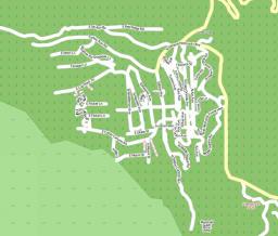
Previously I wrote on preparations to map Summerhaven for OpenStreetMap (OSM). This weekend we were able to get up there, drive around and take pictures. Here is the map as of yesterday:
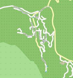
And here is the map today:
As you can see there are less roads. We found that many of the roads just don’t exist. Also after talking to some cabin owners we met, some roads have apparently been cut in two to build more cabins.
Comparing with the Google map we can see that we have missed a section of roads in the North East of Summerhaven, so we will need to go back for those sometime soon. Looking more closely at the Google map I can see many mistakes. Roads connecting when they don’t and the wrong names used.
Interestingly it seems Garmin have also used the incorrect TIGER data for their City Navigator NT. It contained a huge error which I corrected as soon as I saw it several weeks ago on the OSM map.
We marked on the map the locations of restrooms and parking areas, something which doesn’t appear on other maps.
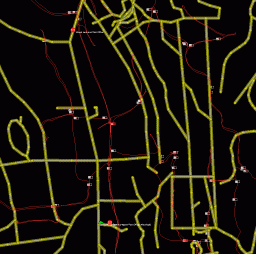
Here is a screenshot showing our GPS trails overlaid on the TIGER data. As you can see the TIGER data is total nonsense.
We have now compiled a list of about half a dozen specific items to look at when we next visit, however I can say that the OSM map must be the most accurate map of Summerhaven that is publically available, even if it isn’t completed yet.
| Print article | This entry was posted by Andy on August 1, 2009 at 9:32 pm, and is filed under Mapping. Follow any responses to this post through RSS 2.0. Both comments and pings are currently closed. |
Comments are closed.


